Cemetery Map

Map of a cemetery with numbered plots and roads.

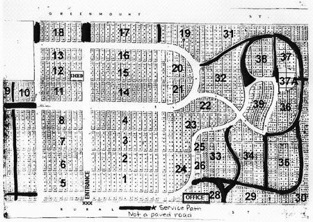
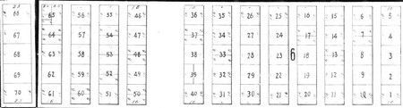
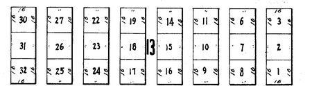
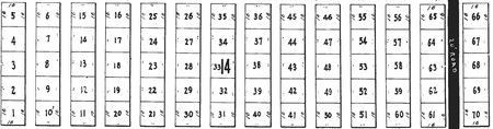
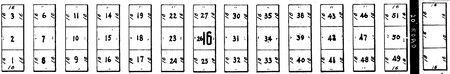
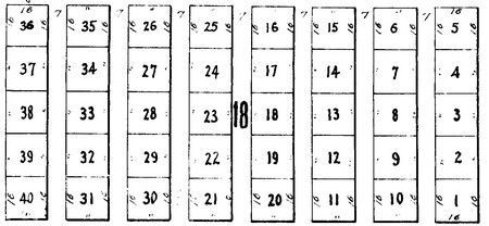
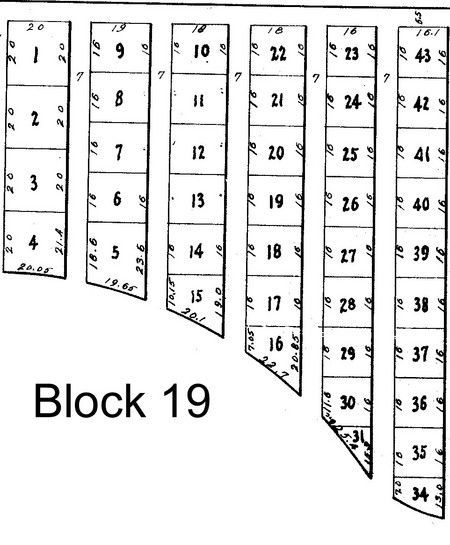
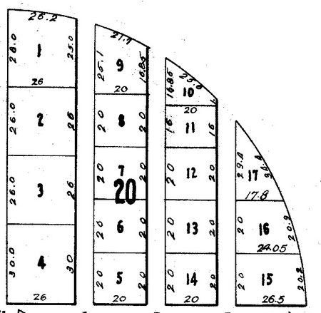
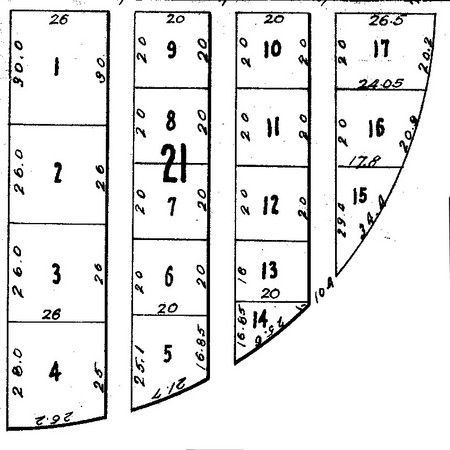
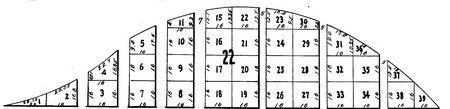
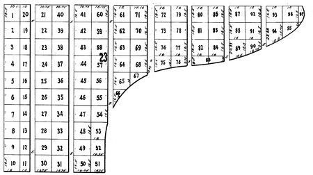
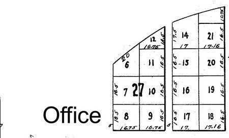
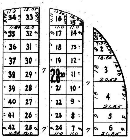
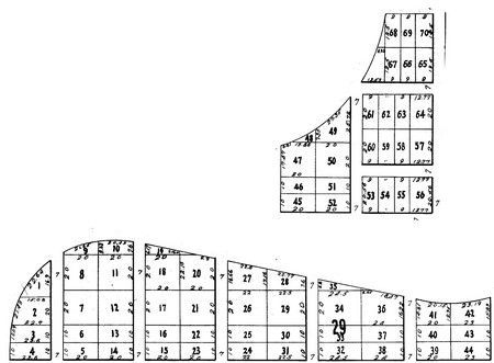
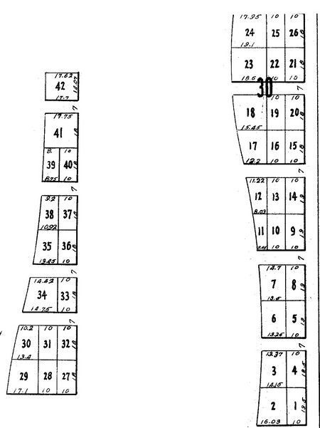
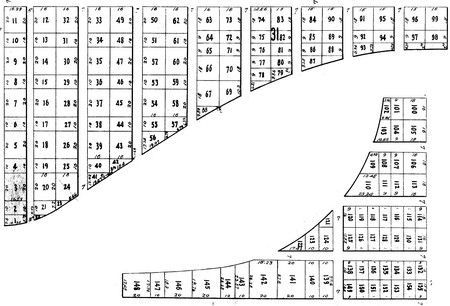
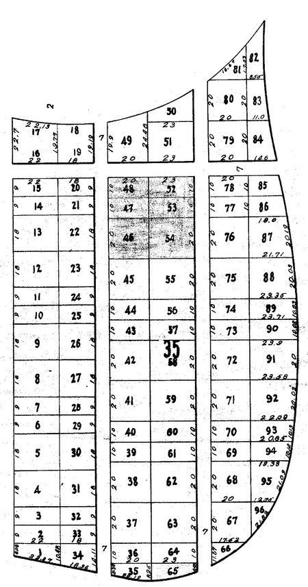
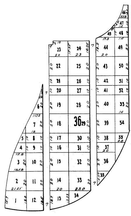
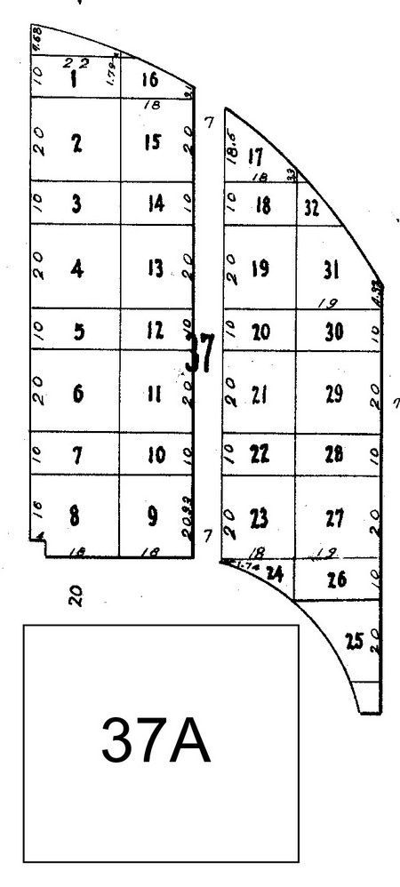
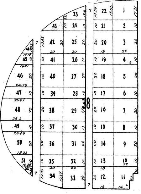
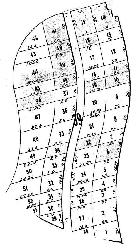
The map above represents the layout of the cemetery grounds. Each numbered section is a Block section. Each block contains specific lot and grave numbers within it. For information on where an individual is buried, contact the cemetery office or open the Database of burials and search alphabetically . The blacked out areas are grass paths for cemetery staff and equipment only. Please keep your vehicles off of these paths.

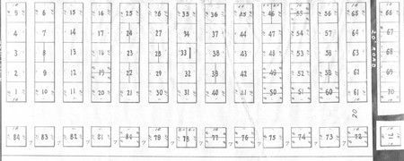
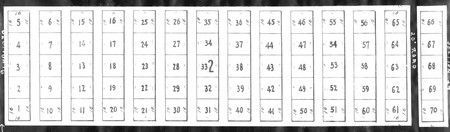
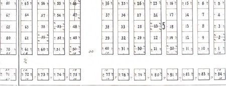
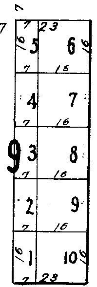
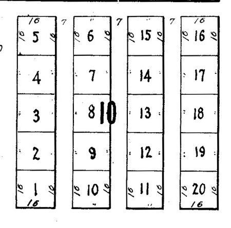
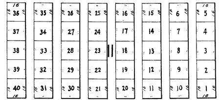
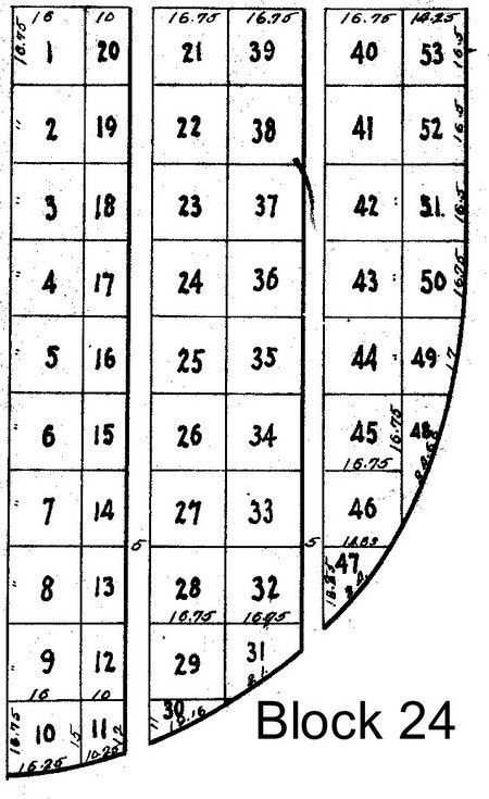
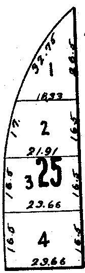
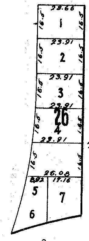
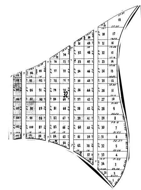
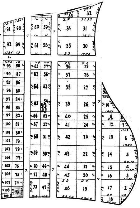
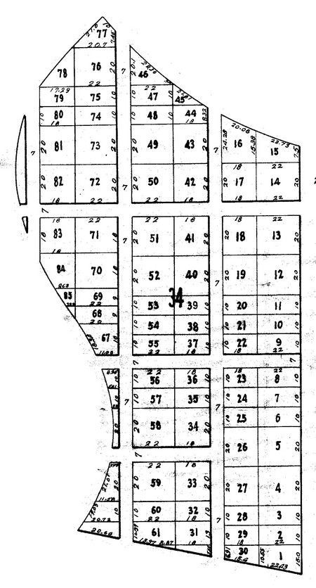
The block pictures show each block with the lots marked out.

Block 1

Diagram of numbered blocks, possibly seating or storage.

Blocks 2,3 & 4

A table with multiple rectangular cells numbered from 1 to 70.

Block 5

Diagram of numbered blocks, potentially a seating chart or map.

Blocks 6, 7, & 8

Numbered grid, likely seating arrangement or a diagram, with a series of rectangular blocks.

Block 9

A grid with numbers 1-10 inside. Additional numbers and lines are adjacent to the grid.

Block 10

Layout of twenty numbered rectangular boxes.

Blocks 11 & 12

Rows of numbered rectangular blocks, possibly for a planting grid, with numbers 1-40.

Block 13

Numbered rectangular blocks arranged in a row.

Blocks 14, 15, & 17

Numbered blocks arranged in columns.

Block 16

A grid of numbered boxes.

Block 18

A diagram with numbered rectangular blocks, possibly for a grid or layout.

Block 19

Diagram of numbered rectangular plots arranged in rows, labeled

Block 20

Diagram showing four columns, each divided into numbered rectangles with varying dimensions, likely related to measurement.

Block 21

Diagram of numbered rectangular and trapezoidal lots, showing dimensions and a central lot marked

Block 22

Diagram of a curved structure divided into numbered sections, possibly for architectural or engineering representation.

Block 23

Number grid with columns of varying heights, numbered 1-96, organized in a descending, jagged shape.

Block 24

Block 24 map with numbered rectangular plots.

Block 25

Diagram of a shape divided into four sections labeled 1-4 with measurements.

Block 26

Diagram of land plots, numbered 1-7, with dimensions and measurements in a vertical layout.

Block 27

Floor plan of an office, with numbered rectangular and trapezoidal rooms, and labeled

Block 28

Diagram of three curved columns divided into numbered squares with text labels.

Block 29

Diagram of multiple oddly shaped rectangular sections, each labeled with a number.

Block 30

A map of numbered rectangular blocks, possibly for a city or town layout.

Block 31

Diagram of a ship's hull, showing numbered sections.

Block 32

Diagram of a complex shape divided into numbered rectangular and triangular sections.

Block 33

Diagram of numbered rectangular sections, arranged in a layout resembling a ship's compartments.

Block 34

Map of a city or town divided into numbered rectangular and trapezoidal plots, streets visible.

Block 35

Map of numbered blocks, possibly for seating or a grid.

Block 36

Diagram with numbered rectangular and curved sections, possibly a building plan.

Block 37, 37A

Diagram of lots 1-31 and lot 37A. The lots are rectangular and semi-circular.

Block 38

Diagram of numbered plots of land.

Block 39

Diagram with numbered, segmented areas. Some areas are shaded.